The search for a missing airliner
NOTE: With the exception of the map, the linked images can be downloaded in a larger format (3000 x 2000 pixels) and used by news organizations interested in illustrating stories about the difficulties involved in the search for the missing plane. All I request is notification of and credit for such use.
MECHANICSVILLE, Va. — Many of you may have heard about the Adam Air jetliner that was reported missing Monday in Indonesia. The story has been an especially tragic one. Reports early on Tuesday said that survivors, including three Americans, had been found. Those reports were refuted later by Indonesian authorities.
The initial news that the Boeing 737 had disappeared must have been disturbing enough on the families and friends of passengers and crew, but the added confusion — with the raising then dashing of hopes — must be making matters even worse.

Map of Sulawesi. (Copyright © 2007 David M. Lawrence)
The flight took off from Surabaya, on the island of Java, heading toward Manado, on the northern tip of Sulawesi. It would have had to cross first the Java Sea, then possibly over portions of the Flores Sea, and ultimately the Makassar Strait before having to cross the mountainous center of the spindle-like Sulawesi. Once over Sulawesi, the flight path would likely have taken it from about halfway between Ujung Pandang in the southwest and Palu in the center, over to Manado in the northwestern tip.

The southeast coast of Borneo. (Copyright © 2007 David M. Lawrence)
I made a round-trip between Balikpapan, on the island of Borneo, and Ujung Pandang during my expedition to Indonesia in 1994. The flight from Balikpapan to Ujung Pandang was more or less direct, crossing only the Makassar Strait. The strait is a large and deep channel. At the time I flew, weather was reasonably clear, but the strait can be a difficult place to find anything in the stormy conditions that have prevailed this week; locating wreckage can be nearly impossible. It does not help that much of the coastlines lining the strait are sparsely populated, making it even more unlikely that anything that washes ashore will be quickly noticed.

The mountainous terrain of central Sulawesi makes searching for wreckage difficult. (Copyright © 2007 David M. Lawrence)
Conditions for those searching for wreckage on land are even more challenging. Central Sulawesi is mountainous, sparsely populated, and heavily forested. After a brief meeting with other members of the expedition in Ujung Pandang, I took a one-stop flight back to Balikpapan. The stop was in Palu, a city at the head of a bay that partially cuts across the peninsula leading to Manado.

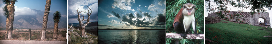
Clouds obscure the landscape. (Copyright © 2007 David M. Lawrence)
Among the many challenges are the rugged slopes. Wreckage can be scattered in such a way as to hide evidence of the impact of an aircraft. Then the tropical climate comes into play. In the humid air, a little bit of uplift — common in mountainous terrain as the ridges force moving air up and over the barriers — leads to rampant cloud formation. Clouds obscure the ground directly by coming between the surface and the observer, but clouds also cast shadows over portions of territory that are in the observer’s direct line of vision.

Even when clouds don't obscure the landscape, the forest cover seems impenetrable. (Copyright © 2007 David M. Lawrence)
Another problem is the seemingly endless, featureless terrain. Forest-covered ridges follow forest-covered ridges. Haze obscures view of more distant areas. Landmarks are difficult to discern, as one mountainous spur looks like another. The conditions are enough to fill searchers with despair. The nature of this remote, rugged, sparsely populated territory makes it easy for rumors to spread unchecked to raise false hopes elsewhere.

Visibility improves where forests have been cleared, such as in the river valleys. (Copyright © 2007 David M. Lawrence)
These images above should show how difficult it is to spot a crash site by air in this region. But the image at right should show how difficult it is to mount a land-based search. Clearings reach up from the lowlands into the montane forests, but they only go so far. None can be regarded as an easy point of entry to the interior of Sulawesi’s forests.
The final photograph (below) was taken as my return flight to Balikpapan left Palu and was making its turn over the Makassar Strait. Here you can see all the factors — terrain, forests, water, and weather — that are making the search for the missing airliner so difficult.

Hills, Water, and Waves -- a final glimpse of Sulawesi as I fly out of Palu on the way back to Borneo. (Copyright © 2007 David M. Lawrence)
Share this:

Leave a Response
You must be logged in to post a comment.

You must be logged in to post a comment.